NEO News
New Dataset: Water Equivalent Anomaly
June 29th, 2011 by Kevin Ward
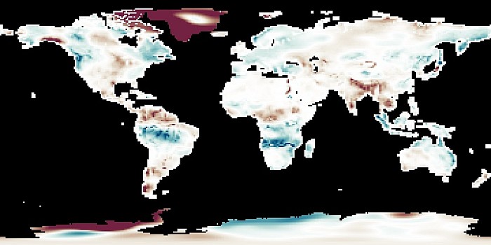
These maps show how water stored on and in the land changes from month to month. The maps are blue where there is more water than average and red where there is less water. Water accumulates on land in rivers and lakes, as ground water and soil moisture, and as snow and ice. Scientists track water both to understand the water cycle and to monitor the availability of fresh water. The maps show that water levels change throughout the year with the seasons. Changes from year to year may reveal drought or an excess of water. These data currently include monthly composites from April 2002 to present.
View the complete collection and read more about water equivalent anomaly on NEO.
Comments Off on New Dataset: Water Equivalent Anomaly
- Browse by Topic
- Analysis
- NEO in the Media
- New Datasets
- Services
- Uncategorized
- Browse by Date
- July 2025
- August 2024
- May 2023
- April 2021
- February 2021
- December 2020
- November 2020
- October 2020
- September 2020
- June 2019
- March 2019
- April 2015
- April 2014
- December 2013
- November 2013
- August 2013
- March 2013
- June 2012
- June 2011
- April 2011
- November 2010
- August 2010
- February 2009
- May 2008
- April 2007


![Average Land Surface Temperature [Day]](/images/datasets/132x66/MOD_LSTD_CLIM_M.jpg)
![Average Land Surface Temperature [Night]](/images/datasets/132x66/MOD_LSTN_CLIM_M.jpg)


![Land Surface Temperature Anomaly [Day]](/images/datasets/132x66/MOD_LSTAD_M.jpg)
![Land Surface Temperature Anomaly [Night]](/images/datasets/132x66/MOD_LSTAN_M.jpg)
![Land Surface Temperature [Day]](/images/datasets/132x66/MOD_LSTD_M.jpg)
![Land Surface Temperature [Night]](/images/datasets/132x66/MOD_LSTN_M.jpg)


