


![Average Land Surface Temperature [Day]](/images/datasets/132x66/MOD_LSTD_CLIM_M.jpg)
![Average Land Surface Temperature [Night]](/images/datasets/132x66/MOD_LSTN_CLIM_M.jpg)


![Land Surface Temperature Anomaly [Day]](/images/datasets/132x66/MOD_LSTAD_M.jpg)
![Land Surface Temperature Anomaly [Night]](/images/datasets/132x66/MOD_LSTAN_M.jpg)
![Land Surface Temperature [Day]](/images/datasets/132x66/MOD_LSTD_M.jpg)
![Land Surface Temperature [Night]](/images/datasets/132x66/MOD_LSTN_M.jpg)


Greenland / Antarctica Elevation
About this dataset
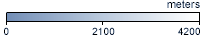
The shades on this map show how high above sea level are the land surfaces and ice sheets on Greenland and Antarctica. White shows the highest land and ice surfaces--up to 4,000 meters above sea level. Light blue and dark blue show progressively lower land and ice surfaces. Light blue areas are about 2,000 meters above sea level. Dark blue shows sea level.
Get Data
Related Websites
Further Reading
Resolving the Discrepancy
The Gravity of Water
Making a Map of Water and Ice
Research Roundup: Depicting Change Across Earth’s Frozen Places
ATBD (Algorithm Theoretical Basis Document)
Credits
Imagery produced by the NASA Earth Observations team based on data provided by Donghui Yi and John DiMarzio, GLAS/ICESat Science Team.
Federal Geographic Data Committee Geospatial Metadata
View the FGDC Metatdata for Greenland / Antarctica Elevation