


![Average Land Surface Temperature [Day]](/images/datasets/132x66/MOD_LSTD_CLIM_M.jpg)
![Average Land Surface Temperature [Night]](/images/datasets/132x66/MOD_LSTN_CLIM_M.jpg)


![Land Surface Temperature Anomaly [Day]](/images/datasets/132x66/MOD_LSTAD_M.jpg)
![Land Surface Temperature Anomaly [Night]](/images/datasets/132x66/MOD_LSTAN_M.jpg)
![Land Surface Temperature [Day]](/images/datasets/132x66/MOD_LSTD_M.jpg)
![Land Surface Temperature [Night]](/images/datasets/132x66/MOD_LSTN_M.jpg)


Albedo (1 month)
About this dataset
When sunlight reaches the Earth’s surface, some of it is absorbed and some is reflected. The relative amount (ratio) of light that a surface reflects compared to the total sunlight that falls on it is called albedo. Surfaces that reflect a lot of the light falling on them are bright, and they have a high albedo. Surfaces that don’t reflect much light are dark, and they have a low albedo. Snow has a high a albedo, and forests have a low albedo.What do the colors mean?
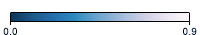
These maps show albedo on a scale from 0 (no incoming sunlight being reflected) to 0.9 (nearly all incoming light being reflected). Darker blue colors indicate that the surface is not reflecting much light, while paler blues indicate higher proportions of incoming light are being reflected. Black areas indicate “no data,” either over ocean or because persistent cloudiness prevented enough views of the surface. Our planet’s brightest surfaces (highest albedos) are ice caps, glaciers, and snow-covered ground. Deserts also have high albedos. Forests have low albedos, especially boreal forests during summer months.
Get Data
1. Visit LP DAAC
2. Select Access Data
3. Choose one of the data access tools listed and search for the dataset name (MCD43C3)
Related Websites
Further Reading
Research Satellites for Atmospheric Sciences, 1978 to Present
Global Albedo
Terra Turns Five
Winter in Southern Greenland
Ship Tracks Off The Kamchatka Peninsula
Signs of Ships in the Clouds
ATBD (Algorithm Theoretical Basis Document)
Credits
Imagery produced by the NASA Earth Observations team using data provided by the MODIS Land Science Team.
Federal Geographic Data Committee Geospatial Metadata
View the FGDC Metatdata for Albedo (1 month)