


![Average Land Surface Temperature [Day]](/images/datasets/132x66/MOD_LSTD_CLIM_M.jpg)
![Average Land Surface Temperature [Night]](/images/datasets/132x66/MOD_LSTN_CLIM_M.jpg)


![Land Surface Temperature Anomaly [Day]](/images/datasets/132x66/MOD_LSTAD_M.jpg)
![Land Surface Temperature Anomaly [Night]](/images/datasets/132x66/MOD_LSTAN_M.jpg)
![Land Surface Temperature [Day]](/images/datasets/132x66/MOD_LSTD_M.jpg)
![Land Surface Temperature [Night]](/images/datasets/132x66/MOD_LSTN_M.jpg)


Carbon Monoxide (1 month - Terra/MOPITT)
About this dataset
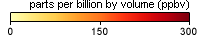
Colorless, odorless, and poisonous, carbon monoxide is a gas that comes from burning fossil fuels, like the gas in cars, and burning vegetation. Carbon monoxide is not one of the gases that is causing global warming, but it is one of the air pollutants that leads to smog. These data sets show monthly averages of carbon monoxide across the Earth measured by the Measurements of Pollution In The Troposphere (MOPITT) sensor on NASA's Terra satellite. Different colors show different amounts of the gas in the troposphere, the layer of the atmosphere closest to the Earth's surface, at an altitude of about 12,000 feet.
Related Websites
Further Reading
MOPITT Views Carbon Monoxide Concentration
Carbon Monoxide Over Western Russia
Fourteen Years of Carbon Monoxide from MOPITT
Fires Put A Carbon Monoxide Cloud Over Indonesia
ATBD (Algorithm Theoretical Basis Document)
Credits
Imagery produced by the NASA Earth Observations team based on data provided by the National Center for Atmospheric Research (NCAR) and the University of Toronto MOPITT Teams.
Federal Geographic Data Committee Geospatial Metadata
View the FGDC Metatdata for Carbon Monoxide (1 month - Terra/MOPITT)