


![Average Land Surface Temperature [Day]](/images/datasets/132x66/MOD_LSTD_CLIM_M.jpg)
![Average Land Surface Temperature [Night]](/images/datasets/132x66/MOD_LSTN_CLIM_M.jpg)


![Land Surface Temperature Anomaly [Day]](/images/datasets/132x66/MOD_LSTAD_M.jpg)
![Land Surface Temperature Anomaly [Night]](/images/datasets/132x66/MOD_LSTAN_M.jpg)
![Land Surface Temperature [Day]](/images/datasets/132x66/MOD_LSTD_M.jpg)
![Land Surface Temperature [Night]](/images/datasets/132x66/MOD_LSTN_M.jpg)


Snow Water Equivalent (1 month - Passive Microwave, with optical)
About this dataset
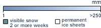
These maps show snow cover across Earth's landscapes. The colors show how many millimeters of water you would get if you converted all of that snow to liquid water. White areas show the highest values (more than 250 mm) while dark, blue-gray areas show low values (down to 1 mm). Land areas with no snow cover are light brown; lakes and oceans are light gray. Scientists track snow extent because many communities rely upon snowmelt as a main source of freshwater. Snowmelt also moistens the soil, which helps to prevent wildfires in summer.
Get Data
1. Visit the NSIDC site
2. Make sure you create/ sign in to your Earthdata account
3. Download via HTTPS for the dataset you need
Related Websites
Global Monthly EASE-Grid Snow Water Equivalent Climatology
National Snow & Ice Data Center
Credits
Images by the National Snow and Ice Data Center, using satellite passive microwave data from the Scanning Multichannel Microwave Radiometer (SMMR) and the Special Sensor Microwave/Imager (SSM/I), enhanced with snow cover frequency data from satellite-borne optical sensors.
Federal Geographic Data Committee Geospatial Metadata
View the FGDC Metatdata for Snow Water Equivalent (1 month - Passive Microwave, with optical)