


![Average Land Surface Temperature [Day]](/images/datasets/132x66/MOD_LSTD_CLIM_M.jpg)
![Average Land Surface Temperature [Night]](/images/datasets/132x66/MOD_LSTN_CLIM_M.jpg)


![Land Surface Temperature Anomaly [Day]](/images/datasets/132x66/MOD_LSTAD_M.jpg)
![Land Surface Temperature Anomaly [Night]](/images/datasets/132x66/MOD_LSTAN_M.jpg)
![Land Surface Temperature [Day]](/images/datasets/132x66/MOD_LSTD_M.jpg)
![Land Surface Temperature [Night]](/images/datasets/132x66/MOD_LSTN_M.jpg)


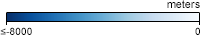
Bathymetry (GEBCO)
About this dataset
Beneath the waters of the world's ocean, the Earth's surface isn't flat like the bottom of a glass or large bowl. There are giant mountain ranges and huge cracks where the ocean floor is ripping apart. Underwater volcanoes are slowly building up into mountains that may one day rise above the sea surface as islands. Because of these features, the depth of the water isn't the same everywhere in the ocean. Bathymetry is the measurement of how deep the water is at various places and the shape of the land underwater. In these maps, different shades of color represent different water depths. The data come from the General Bathymetric Chart of the Oceans, produced by the International Hydrographic Organization (IHO) and the United Nations' (UNESCO) Intergovernmental Oceanographic Commission (IOC).
Get Data
1. Visit GEBCO Data Products
2. Download global gridded in data in netCDF or GeoTIFF
Related Websites
Further Reading
7.0 Quake near Christchurch, New Zealand
Earthquake and Tsunami Near Sendai Japan
Persistent Phytoplankton
Credits
Imagery produced by the NASA Earth Observations team using GEBCO Bathymetric Grid courtesy NOAA.
Federal Geographic Data Committee Geospatial Metadata
View the FGDC Metatdata for Bathymetry (GEBCO)