


![Average Land Surface Temperature [Day]](/images/datasets/132x66/MOD_LSTD_CLIM_M.jpg)
![Average Land Surface Temperature [Night]](/images/datasets/132x66/MOD_LSTN_CLIM_M.jpg)


![Land Surface Temperature Anomaly [Day]](/images/datasets/132x66/MOD_LSTAD_M.jpg)
![Land Surface Temperature Anomaly [Night]](/images/datasets/132x66/MOD_LSTAN_M.jpg)
![Land Surface Temperature [Day]](/images/datasets/132x66/MOD_LSTD_M.jpg)
![Land Surface Temperature [Night]](/images/datasets/132x66/MOD_LSTN_M.jpg)


Land Surface Temperature Anomaly [Night] (1 month)
About this dataset
Land surface temperature is how hot or cold the ground feels to the touch. An anomaly is when something is different from average. These maps show where Earth’s surface was warmer or cooler at night than the average temperatures for the same week or month from 2001-2010. So, a nighttime land surface temperature anomaly map for May 2002 would show how that month’s nighttime temperature was different from the average temperature for all Mays between 2001 and 2010.
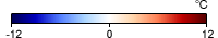
What do the colors mean?
These maps show land surface temperature anomalies for a given day, week, or month compared to the average conditions during that period between 2001-2010. Places that are warmer than average are red, places that were near-normal are white, and places that are cooler than average are blue. Black means there is no data.
Related Websites
Further Reading
Terra Data Confirm Warm Dry US Winter
Hottest Spot
Baked Alaska
Heat Broils the American Southwest
Alaska Hit with a Hot March
Heat and Fire Scorches Siberia
Credits
Imagery produced by the NASA Earth Observations team based on data provided by the Land Processes Distributed Active Archive Center (LPDAAC) and the MODIS Land Science Team.
Federal Geographic Data Committee Geospatial Metadata
View the FGDC Metatdata for Land Surface Temperature Anomaly [Night] (1 month)