


![Average Land Surface Temperature [Day]](/images/datasets/132x66/MOD_LSTD_CLIM_M.jpg)
![Average Land Surface Temperature [Night]](/images/datasets/132x66/MOD_LSTN_CLIM_M.jpg)


![Land Surface Temperature Anomaly [Day]](/images/datasets/132x66/MOD_LSTAD_M.jpg)
![Land Surface Temperature Anomaly [Night]](/images/datasets/132x66/MOD_LSTAN_M.jpg)
![Land Surface Temperature [Day]](/images/datasets/132x66/MOD_LSTD_M.jpg)
![Land Surface Temperature [Night]](/images/datasets/132x66/MOD_LSTN_M.jpg)


Greenland / Antarctica Elevation
About this dataset
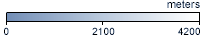
The shades on this map show how high above sea level are the land surfaces and ice sheets on Greenland and Antarctica. White shows the highest land and ice surfaces--up to 4,000 meters above sea level. Light blue and dark blue show progressively lower land and ice surfaces. Light blue areas are about 2,000 meters above sea level. Dark blue shows sea level.