


![Average Land Surface Temperature [Day]](/images/datasets/132x66/MOD_LSTD_CLIM_M.jpg)
![Average Land Surface Temperature [Night]](/images/datasets/132x66/MOD_LSTN_CLIM_M.jpg)


![Land Surface Temperature Anomaly [Day]](/images/datasets/132x66/MOD_LSTAD_M.jpg)
![Land Surface Temperature Anomaly [Night]](/images/datasets/132x66/MOD_LSTAN_M.jpg)
![Land Surface Temperature [Day]](/images/datasets/132x66/MOD_LSTD_M.jpg)
![Land Surface Temperature [Night]](/images/datasets/132x66/MOD_LSTN_M.jpg)


About this dataset
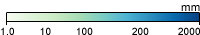
Water is essential for life on Earth, and precipitation is a main source of fresh water for plants and animals. Knowing when, where, and how precipitation falls is critical for science and society. The colored areas on these maps show where and how much precipitation fell around the world on the dates shown and how rain and snow move around the planet. The data are from NASA’s Global Precipitation Measurement (GPM) mission, which provides near-global coverage of precipitation and is updated every half hour. The comprehensive and consistent precipitation measurements from GPM are helping scientists better understand all the elements of Earth’s climate and weather systems along with how these elements are changing.
What do the colors mean?
Dark blue areas show where a lot of rain has fallen. Pale green to turquoise show increasing amounts of rainfall.
Get Data
1. Visit the GES DISC site for daily and monthly TRMM rainfall data
2. Download data from the Data Access pane. You will need to sign in to your Earthdata account
Related Websites
Credits
TRMM imagery provided by NASA Goddard Earth Sciences DISC, based on data from NASA and the Japanese Space Agency (JAXA).
Federal Geographic Data Committee Geospatial Metadata
View the FGDC Metatdata for Rainfall (1 month - TRMM, 1998-2016)